


 July 02,2023
July 02,2023
July 02,2023
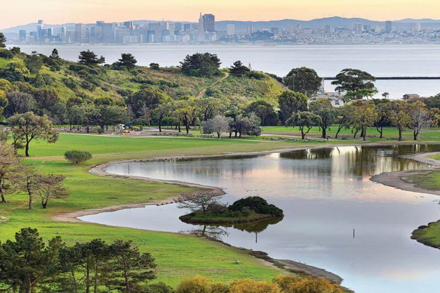
The City of Richmond is located 16 miles northeast of San Francisco, directly across San Francisco Bay. Richmond is on a peninsula separating San Francisco Bay (on the south) and San Pablo Bay (to the north), and the city has 32 total miles of shoreline. The city's total area is 56.0 square miles, of which 33.7 are land area and 22.3 are water area.
Richmond is a growing maritime, industrial, and residential community with a thriving and changing economy, a dynamic business environment, and a strong potential for further growth.
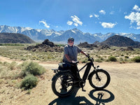
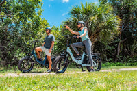
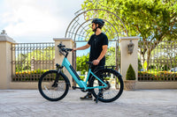
The temperatures are fairly moderate, there are several electric bike paths and designated bike lanes, which has further increased the popularity of bike-riding in a city already spinning with enthusiasm for it. This list is not inclusive as there are many bike robikeutes in Richmond but here are some of the bbikeikee routes you can enjoy in it!
Route#1. Wildcat Canyon Regional Park Loop
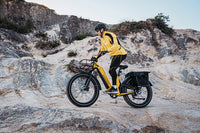
Wildcat Canyon Regional Park Loop was made of Wildcat Creek Trail, Havey Creek Trail, San Pablo Ridge Trail, and Belgum Trail is an 11.6 kilometer heavily trafficked loop trail located near Richmond, California that features beautiful wildflowers and is rated as moderate. The trail is primarily used for hiking, walking, ebiking, running, and bird watching and is accessible year-round. Dogs are also able to use this trail.
Wildcat Canyon Regional Park encompasses 2,430 acres along the Wildcat Creek watershed and the surrounding hills and ridges. On east-facing slopes grow large coast live oaks, bay laurels, and a scattering of big leaf maples and madrones. North-facing hillsides support beautiful stands of bay laurel, fringed with coast live oak, coyote brush, poison oak, elderberry, snowberry, bracken fern, and blackberry. Picnic and barbecue facilities, a children’s playground, and restrooms and drinking water are available in the Alvarado Area near the starting point.
This trail begins on a wide fire road but soon winds through native woodlands and along shaded creek beds, ascending (Pedaling technique is important,but mountain e-bike especially Magicycle will help with uphill riding.) to a lookout point with breathtaking views of San Francisco, the Golden Gate and Bay bridges, and Marin to the west, San Pablo Bay and Point Pinole to the north, and Mt. Diablo, San Pablo Reservoir, Briones, and other East Bay parks to the east. You can refill water bottles about 2 miles into the hike, just before the Havey Canyon turn, and at the intersection of Mezue and Wildcat Creek trails.
Route#2. Miller/Knox Regional Shoreline loop
Ferry Point Path, San Francisco Bay Trail and Ferry Point Loop Trail is a 3.1 kilometer moderately trafficked loop trail located near Richmond, California that features a lake and is good for all skill levels. The trail offers a several activity options and is accessible year-round. Dogs are also able to use this trail but must be kept on leash.
Offering stunning views of the San Francisco Bay, this trail is suitable for all skill levels as well as dogs on leash. The trail is almost completely paved and flat making it suitable for cycling and wheelchairs. Bathrooms and water are located next to the Ferry Point Parking area as well as along the loop portion of the trail. Bring a picnic lunch for after your hike or check out the train museum across the street.
From Ferry Point parking area, head east toward the fishing pier along the Ferry Point paved path. When you arrive at the fishing pier there will be a water fountain. To the right you will see where the gravel path starts. Follow the gravel path left along the shoreline until you reach the paved Ferry Point Loop trail .2 miles. Follow the loop around the pond. On your way back toward the pier, when you reach the gravel path intersection head left on the paved path back to the Ferry Point parking area.
There are 3 designated accessible spaces in the paved parking lot off of Dornan Drive at the south end of the trail. All of them are van-accessible with striped access aisles. Additionally, there are 4 designated accessible spaces in the paved parking lot off of Dornan Drive at the east end of the trail. All of them are van-accessible with striped access aisles. This parking lot has been marked with a waypoint.
Route#3. Bay, Marine View, Crest and West Trail Loop
Bay, Marine View, Crest and West Trail Loop is a 6.3 kilometer moderately trafficked loop trail located near Richmond, California that offers scenic views and is rated as moderate. The trail offers a number of activity options and is accessible year-round.
This trail not only features several sites of key importance to the park’s history, Ferry Point and Nicholl Knob, it also provides sweeping views from the hill crest of the East Bay, the San Francisco Bay and beyond. Please note, sections of the trail are very steep and uneven.
Trail Directions: From Ferry Point Parking Lot, head west to Ferry Point. At the point, follow the San Francisco Bay Trail along the shoreline. At the lagoon, turn left to continue on San Francisco Bay Trail along the west side of the lagoon. At the restroom, turn left and follow the trail up to Dornan Drive, following Dornan Drive to the left until you reach Western Drive, just before the tunnel. Cross safely at the crosswalk and turn left. After about 100 ft, turn right at the sign that says “path” and follow thtrail uphill towards Belvedere Ave. At Belvedere Ave, continue right and up the dirt path. You will intersect with a Old Country Road; make a left and continue for about 800 feet. Turn left at the fork onto Marine View Trail, then after about 200 feet, turn left to connect to Crest Trail. At the paved road, turn left and head about 100 feet towards the gate. At the gate, turn right onto Crest Trail and follow to the top of the hill at Nicholl Knob.
Route#4. Havey Canyon and Mezue Trail Loop
Havey Canyon and Mezue Trail Loop is a 7.9 kilometer moderately trafficked loop trail located near Richmond, California that features beautiful wild flowers and is rated as moderate. The trail is primarily used for hiking, walking, running, and bird watching.
Route#5. Point Isabel Regional Shoreline
Point Isabel Regional Shoreline is a 3.2 kilometer heavily trafficked loop trail located near Richmond, California that features beautiful wild flowers and is good for all skill levels.
The trail is primarily used for walking and nature trips and is accessible year-round.
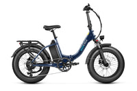
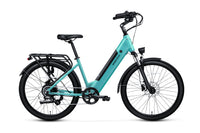
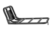
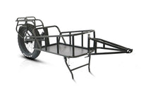
Magicycle 52V Most Powerful ALL Terrain Ebike Only $1589! 10% OFF for All Ebike Accessories. Limited Offer. Don't miss it! Free Shipping for Order over $50.
Richmond is a growing maritime, industrial, and residential community with a thriving and changing economy, a dynamic business environment, and a strong potential for further growth.
The temperatures are fairly moderate, there are several electric bike paths and designated bike lanes, which has further increased the popularity of bike-riding in a city already spinning with enthusiasm for it. This list is not inclusive as there are many bike robikeutes in Richmond but here are some of the bbikeikee routes you can enjoy in it!
Route#1. Wildcat Canyon Regional Park Loop
Wildcat Canyon Regional Park Loop was made of Wildcat Creek Trail, Havey Creek Trail, San Pablo Ridge Trail, and Belgum Trail is an 11.6 kilometer heavily trafficked loop trail located near Richmond, California that features beautiful wildflowers and is rated as moderate. The trail is primarily used for hiking, walking, ebiking, running, and bird watching and is accessible year-round. Dogs are also able to use this trail.
Wildcat Canyon Regional Park encompasses 2,430 acres along the Wildcat Creek watershed and the surrounding hills and ridges. On east-facing slopes grow large coast live oaks, bay laurels, and a scattering of big leaf maples and madrones. North-facing hillsides support beautiful stands of bay laurel, fringed with coast live oak, coyote brush, poison oak, elderberry, snowberry, bracken fern, and blackberry. Picnic and barbecue facilities, a children’s playground, and restrooms and drinking water are available in the Alvarado Area near the starting point.
This trail begins on a wide fire road but soon winds through native woodlands and along shaded creek beds, ascending (Pedaling technique is important,but mountain e-bike especially Magicycle will help with uphill riding.) to a lookout point with breathtaking views of San Francisco, the Golden Gate and Bay bridges, and Marin to the west, San Pablo Bay and Point Pinole to the north, and Mt. Diablo, San Pablo Reservoir, Briones, and other East Bay parks to the east. You can refill water bottles about 2 miles into the hike, just before the Havey Canyon turn, and at the intersection of Mezue and Wildcat Creek trails.
Route#2. Miller/Knox Regional Shoreline loop
Ferry Point Path, San Francisco Bay Trail and Ferry Point Loop Trail is a 3.1 kilometer moderately trafficked loop trail located near Richmond, California that features a lake and is good for all skill levels. The trail offers a several activity options and is accessible year-round. Dogs are also able to use this trail but must be kept on leash.
Offering stunning views of the San Francisco Bay, this trail is suitable for all skill levels as well as dogs on leash. The trail is almost completely paved and flat making it suitable for cycling and wheelchairs. Bathrooms and water are located next to the Ferry Point Parking area as well as along the loop portion of the trail. Bring a picnic lunch for after your hike or check out the train museum across the street.
From Ferry Point parking area, head east toward the fishing pier along the Ferry Point paved path. When you arrive at the fishing pier there will be a water fountain. To the right you will see where the gravel path starts. Follow the gravel path left along the shoreline until you reach the paved Ferry Point Loop trail .2 miles. Follow the loop around the pond. On your way back toward the pier, when you reach the gravel path intersection head left on the paved path back to the Ferry Point parking area.
There are 3 designated accessible spaces in the paved parking lot off of Dornan Drive at the south end of the trail. All of them are van-accessible with striped access aisles. Additionally, there are 4 designated accessible spaces in the paved parking lot off of Dornan Drive at the east end of the trail. All of them are van-accessible with striped access aisles. This parking lot has been marked with a waypoint.
Route#3. Bay, Marine View, Crest and West Trail Loop
Bay, Marine View, Crest and West Trail Loop is a 6.3 kilometer moderately trafficked loop trail located near Richmond, California that offers scenic views and is rated as moderate. The trail offers a number of activity options and is accessible year-round.
This trail not only features several sites of key importance to the park’s history, Ferry Point and Nicholl Knob, it also provides sweeping views from the hill crest of the East Bay, the San Francisco Bay and beyond. Please note, sections of the trail are very steep and uneven.
Trail Directions: From Ferry Point Parking Lot, head west to Ferry Point. At the point, follow the San Francisco Bay Trail along the shoreline. At the lagoon, turn left to continue on San Francisco Bay Trail along the west side of the lagoon. At the restroom, turn left and follow the trail up to Dornan Drive, following Dornan Drive to the left until you reach Western Drive, just before the tunnel. Cross safely at the crosswalk and turn left. After about 100 ft, turn right at the sign that says “path” and follow thtrail uphill towards Belvedere Ave. At Belvedere Ave, continue right and up the dirt path. You will intersect with a Old Country Road; make a left and continue for about 800 feet. Turn left at the fork onto Marine View Trail, then after about 200 feet, turn left to connect to Crest Trail. At the paved road, turn left and head about 100 feet towards the gate. At the gate, turn right onto Crest Trail and follow to the top of the hill at Nicholl Knob.
Route#4. Havey Canyon and Mezue Trail Loop
Havey Canyon and Mezue Trail Loop is a 7.9 kilometer moderately trafficked loop trail located near Richmond, California that features beautiful wild flowers and is rated as moderate. The trail is primarily used for hiking, walking, running, and bird watching.
Route#5. Point Isabel Regional Shoreline
Point Isabel Regional Shoreline is a 3.2 kilometer heavily trafficked loop trail located near Richmond, California that features beautiful wild flowers and is good for all skill levels.
The trail is primarily used for walking and nature trips and is accessible year-round.
Magicycle 52V Most Powerful ALL Terrain Ebike Only $1589! 10% OFF for All Ebike Accessories. Limited Offer. Don't miss it! Free Shipping for Order over $50.


